Chương trình Địa tầng được thiết kế để đánh giá kết quả từ khảo sát địa chất (các hố khoan, CPT, DPT, SPT, DMT ... và hơn nữa), tạo mô hình địa chất 2D hoặc 3D và xuất mặt cắt cùng trụ hố khoan vào các chương trình GEO5 khác.
Những tiện ích mở rộng có sẵn: mô đun Nhật ký cho báo cáo dữ liệu địa chất, mô đun tạo Mặt cắt để tạo ra các mặt cắt trụ địa chất, mô đun Công tác đất để mô hình hóa công tác đất cũng như tính toán khối lượng.
Ứng dụng di động Thu thập dữ liệu (Data Collector) có thể được sử dụng để thu thập dữ liệu tại hiện trường hoặc trong phòng trong thí nghiệm.
More Features

GEO5 tạo báo cáo đầu ra bằng nhiều ngôn ngữ - thuận tiện cho các dự án nước ngoài.
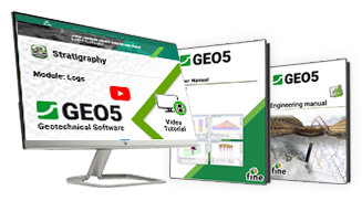
Các tài liệu dạy và hướng dẫn của chúng tôi sẽ giúp bạn nắm vững cách sử dụng phần mềm một cách nhanh chóng.
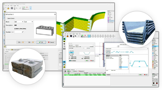
GEO5 chứa các danh mục biên dạng, cọc ván, neo, đinh, lưới địa kỹ thuật và khối.
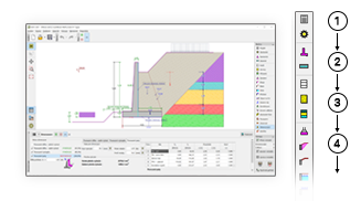
Các chương trình của GEO5 có môi trường thống nhất và lưu đồ trực quan từ trên xuống.
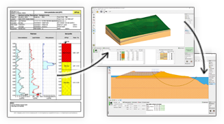
GEO5 tích hợp mô hình hóa dữ liệu địa chất với các tác vụ địa kỹ thuật nâng cao.
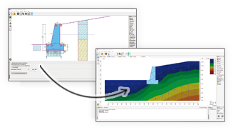
GEO5 cho phép so sánh hai giải pháp độc lập.
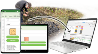
Thu thập dữ liệu địa chất tại hiện trường và gửi đến mô đun Địa tầng.
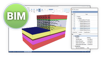
GEO5 có thể xuất dữ liệu sang các định dạng BIM chung và chia sẻ chung và chia sẻ chúng với các chương trình thứ 3.
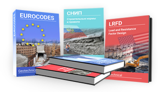
GEO5 là một công cụ quốc tế cho các kỹ sư trên toàn thế giới.
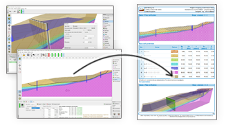
Báo cáo đầu ra của GEO5 có thể dễ dàng chỉnh sửa hoặc xuất sang định dạng PDF hoặc MS Word.
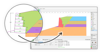
GEO5 cho phép chuyển dữ liệu giữa các mô đun.

GEO5 tạo báo cáo đầu ra bằng nhiều ngôn ngữ - thuận tiện cho các dự án nước ngoài.

Các tài liệu dạy và hướng dẫn của chúng tôi sẽ giúp bạn nắm vững cách sử dụng phần mềm một cách nhanh chóng.

GEO5 chứa các danh mục biên dạng, cọc ván, neo, đinh, lưới địa kỹ thuật và khối.

Các chương trình của GEO5 có môi trường thống nhất và lưu đồ trực quan từ trên xuống.

GEO5 tích hợp mô hình hóa dữ liệu địa chất với các tác vụ địa kỹ thuật nâng cao.

GEO5 cho phép so sánh hai giải pháp độc lập.

Thu thập dữ liệu địa chất tại hiện trường và gửi đến mô đun Địa tầng.

GEO5 có thể xuất dữ liệu sang các định dạng BIM chung và chia sẻ chung và chia sẻ chúng với các chương trình thứ 3.

GEO5 là một công cụ quốc tế cho các kỹ sư trên toàn thế giới.

Báo cáo đầu ra của GEO5 có thể dễ dàng chỉnh sửa hoặc xuất sang định dạng PDF hoặc MS Word.

GEO5 cho phép chuyển dữ liệu giữa các mô đun.

GEO5 tạo báo cáo đầu ra bằng nhiều ngôn ngữ - thuận tiện cho các dự án nước ngoài.

Các tài liệu dạy và hướng dẫn của chúng tôi sẽ giúp bạn nắm vững cách sử dụng phần mềm một cách nhanh chóng.

GEO5 chứa các danh mục biên dạng, cọc ván, neo, đinh, lưới địa kỹ thuật và khối.

The software in general is very good and ties in well with the way we do things here. From our review, the calculation results compares very well with our methods for both slope stability and settlement. The graphics and the ‘point-and-click’ data input are also very good and makes the program very easy to use.

It’s really great how easy the software is. I’m now doing the calculations so much faster and easier than doing it manually and most importantly, the technical customer service team are great and they respond instantly and professionally to any question or clarification. Thank you guys for being so awesome. High fives!

Great software....highly recommend.....always updating/improving and implementing feedback from users.